Timeline for Sacramento rain and Tahoe snow on Sunday

Rain and snow have returned to Northern California and chain controls are in effect for some Sierra travelers. (See further below for more live updates on conditions.)The rain will be steady Sunday morning and occasional wind gusts for 30 mph are possible in the Valley, Meteorologist Eileen Javora says. The rain will taper to showers into the afternoon and end by evening. About .25 to .5 of an inch of rain is expected in Sacramento. Rain in the Foothills will be persistent for most of the day. In the Sierra, snow will continue to fall into Sunday evening with chain controls likely into the night. About a foot of snow will fall at the summit with the snow level around 6,000 feet for most of the day.| RELATED | See the latest road conditions from Caltrans hereAny lingering showers Monday morning will wrap up early, leaving Monday mainly dry. This will be a better day to travel in the Sierra. Tuesday’s storm is aimed at Central California where the most rain will fall. We should still see at least .5 of an inch of rain around Sacramento with higher amounts possible to the south and less to the north. Snow will be heavy at times Tuesday into early Wednesday with 1-2 feet falling south of Highway 50. The snow level will be lower in the 3,000-4,000 feet range. This system may linger into Wed morning, giving us the chance of showers.Here are more California storm updates 8 a.m.: Chain controls are up from Truckee to Rainbow on I-80.| MORE | 2023 season already among top 10 snowiest Sierra winters recordedDownload our app for the latestHere is where you can download our app for the latest weather alerts.Track interactive, Doppler radar(App users, click here to see our interactive radar.)Real-time traffic map(App users, click here to see our real-time traffic map.)Follow our KCRA weather team on social mediaChief meteorologist Mark Finan on Facebook and TwitterMeteorologist Tamara Berg on Facebook and TwitterMeteorologist Eileen Javora on FacebookMeteorologist Dirk Verdoorn on FacebookMeteorologist/climate reporter Heather Waldman on Facebook and TwitterWatch our forecasts on TV or onlineHere’s where to find our latest video forecast. You can also watch a livestream of our latest newscast here. The banner on our website turns red when we’re live.We’re also streaming on the Very Local app for Roku, Apple TV or Amazon Fire TV.
Rain and snow have returned to Northern California and chain controls are in effect for some Sierra travelers.
(See further below for more live updates on conditions.)
The rain will be steady Sunday morning and occasional wind gusts for 30 mph are possible in the Valley, Meteorologist Eileen Javora says.
The rain will taper to showers into the afternoon and end by evening. About .25 to .5 of an inch of rain is expected in Sacramento.
Rain in the Foothills will be persistent for most of the day.
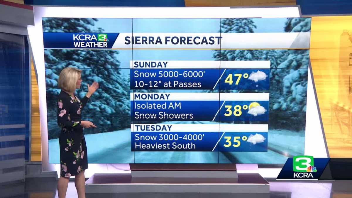
In the Sierra, snow will continue to fall into Sunday evening with chain controls likely into the night. About a foot of snow will fall at the summit with the snow level around 6,000 feet for most of the day.
| RELATED | See the latest road conditions from Caltrans here
This content is imported from Twitter.
You may be able to find the same content in another format, or you may be able to find more information, at their web site.
Any lingering showers Monday morning will wrap up early, leaving Monday mainly dry. This will be a better day to travel in the Sierra.
Tuesday’s storm is aimed at Central California where the most rain will fall. We should still see at least .5 of an inch of rain around Sacramento with higher amounts possible to the south and less to the north. Snow will be heavy at times Tuesday into early Wednesday with 1-2 feet falling south of Highway 50. The snow level will be lower in the 3,000-4,000 feet range.
This system may linger into Wed morning, giving us the chance of showers.
Here are more California storm updates
8 a.m.: Chain controls are up from Truckee to Rainbow on I-80.
This content is imported from Twitter.
You may be able to find the same content in another format, or you may be able to find more information, at their web site.
| MORE | 2023 season already among top 10 snowiest Sierra winters recorded
Download our app for the latest
Here is where you can download our app for the latest weather alerts.
Track interactive, Doppler radar
(App users, click here to see our interactive radar.)
Real-time traffic map
(App users, click here to see our real-time traffic map.)
Follow our KCRA weather team on social media
Watch our forecasts on TV or online
Here’s where to find our latest video forecast. You can also watch a livestream of our latest newscast here. The banner on our website turns red when we’re live.
We’re also streaming on the Very Local app for Roku, Apple TV or Amazon Fire TV.


